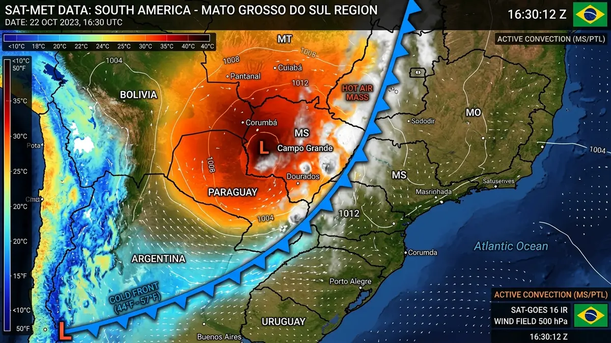
Storm Alert: Cold Front Advances and Triggers Extreme Thermal Shock in MS

An intense cold air mass of subpolar origin advanced over the south-central region of South America on this day of July 30, 2026. This rapid movement triggered a drastic change in the climatological pattern of the state of Mato Grosso do Sul. The National Institute of Meteorology issued multiple potential danger alerts for dozens of municipalities in Mato Grosso do Sul due to the imminent risk of severe storms.
The collision of this cold mass with the extremely hot and dry air that was parked in the north generated intense instabilities. Meteorologists point out that the speed of movement of the cold front enhanced the formation of cumulonimbus clouds. These formations are known to cause high-intensity winds and localized rain showers. The population was advised to avoid open areas and not seek shelter under trees during the most severe wind gusts.
Wind gusts exceeded the 70 km/h mark at several automatic monitoring stations in the capital, Campo Grande. Several occurrences of fallen trees and partial unroofing required immediate action by local security forces. The maintenance teams of the electric utility concessionaire were called to restore supply in neighborhoods affected by fallen cables. The State Civil Defense remained on permanent duty to coordinate urban emergency calls.