🌍 Your knowledge portal
Science and Nature

Hidden Treasures: Scientists Use Seismic Waves to Map Ice Beneath the Moon's Soil

📅 2026-08-03⏱️ 5 min read📝
Hidden Treasures: Scientists Use Seismic Waves to Map Ice Beneath the Moon's Soil
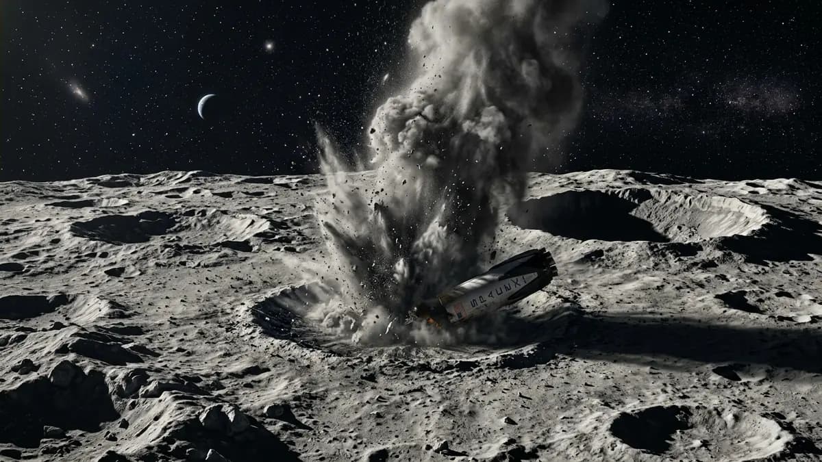
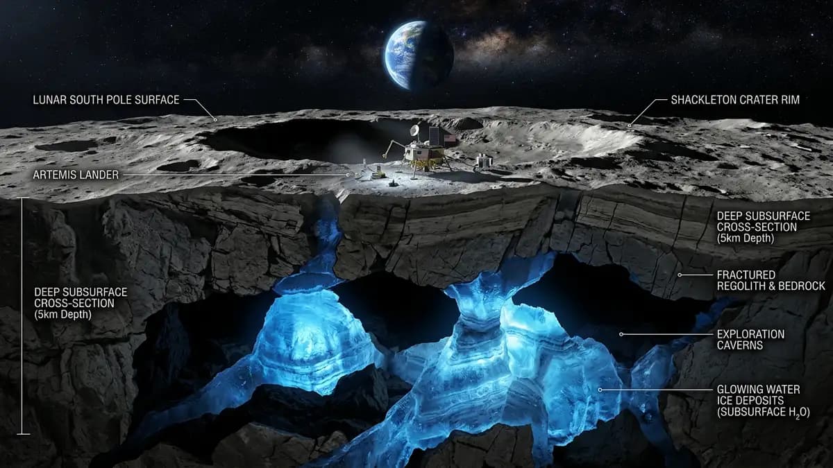
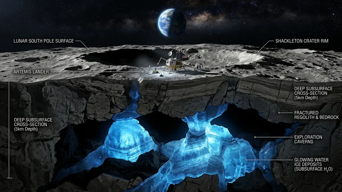
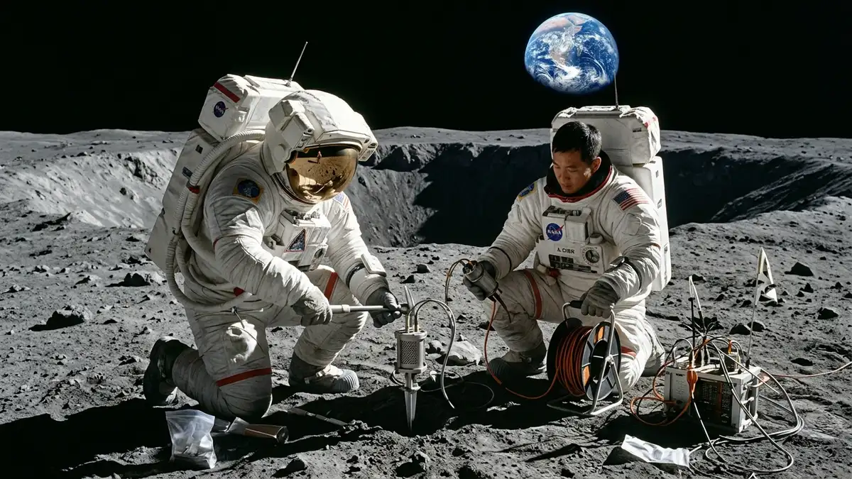
Hidden Treasures: Scientists Use Seismic Waves to Map Ice Beneath the Moon's Soil — High-Fidelity Artistic Illustration created by artificial intelligence based on scientific research.
⚡

Quick Summary

A new scientific technique utilizing the propagation of seismic waves allowed mapping large reservoirs of water ice hidden beneath the Moon's south pole subsurface. The international race to establish permanent human colonies on our natural satellite has just gained an unprecedented technological ally.

Key Takeaways:

  • The physical principle behind seismic mapping is based on the difference in propagation velocity of waves as they traverse different materials.
  • Confirming the presence of large underground water ice reservoirs enables the space economy of the twenty-first century.
  • The research was published in the prestigious scientific journal Science Advances in late July and has resonated strongly within major global space agencies.

Hidden Treasures: Scientists Use Seismic Waves to Map Ice Beneath the Moon's Soil

Mapping Subsurface Ice on the Moon

The international race to establish permanent human colonies on our natural satellite has just gained an unprecedented technological ally. Scientists from several international institutions have developed a revolutionary technique capable of mapping deep ice deposits beneath the Moon's soil. This novel method utilizes the propagation of seismic waves generated by micrometeorite impacts and spontaneous moonquakes to scan the subsurface non-invasively.

The research was published in the prestigious scientific journal Science Advances in late July and has resonated strongly within major global space agencies. Until now, detecting water ice deposits relied on orbital ground-penetrating radars and blind, expensive localized drilling. The new seismic methodology allows creating detailed three-dimensional models of the lunar soil stiffness, pointing out exactly where the ice blocks are hidden.

Scientists focused their initial test algorithms on the lunar South Pole region, which harbors permanently shadowed craters. In these dark rifts, known as PSRs, extreme temperatures have dropped to below minus two hundred degrees Celsius for billions of years. These freezing conditions have kept the water ice untouched by solar radiation, acting as a physical archive of the history of our own Solar System.


How Seismic Waves Reveal Hidden Geological Anomalies #

The physical principle behind seismic mapping is based on the difference in propagation velocity of waves as they traverse different materials. Seismic shear waves (S-waves) and compression waves (P-waves) accelerate significantly when they encounter rigid materials such as compact water ice. When passing through sandy and dry lunar regolith, which is much more porous, the velocity of the waves drops considerably.

Astronauts Installing Seismic Measurement Equipment on the Moon

Special seismic sensors will be installed by astronauts of the Artemis program missions in the vicinity of prominent craters like Shackleton and Cabeus. These delicate instruments will record the minimal mechanical vibrations that constantly traverse the Moon's crust. The data will be transmitted back to Earth for processing in space geophysics supercomputers in real-time.

This advanced subsurface analysis drastically reduces logistical risks for implementing lunar mining industries and support stations. Purified lunar ice will not only serve for the daily water consumption of the future colonies' crews. It will be chemically broken down into breathable oxygen and liquid hydrogen, which function as the most efficient rocket propellants.

The mapping of these space resources is part of a broader network of scientific investigations connecting different worlds of our solar system. The study of objects traveling through deep space, such as the Comet Tempel 2 and Its Historic Approach, helps explain the origin of these volatile compounds. Scientists believe that much of the lunar water came exactly from ancient comet collisions similar to Tempel 2.


Comparative Table of Detection Methods for Water on the Moon #

The table below presents the main methods used by space science to detect water ice deposits on our satellite:

Detection Method Equipment Type Spatial Resolution Maximum Depth Reached Main Limitations Logistical Advantages
Tomographic Seismography Active and passive surface seismometers High resolution (meters) Up to 1.5 kilometers under the soil Requires direct installation of physical networks on the ground Complete three-dimensional mapping without drilling
Ground Penetrating Radar (GPR) Microwave transmitters installed on rovers Medium resolution (tens of meters) About 10 to 50 meters Depth range highly limited by dry regolith Rapid detection along the robot's physical path
Neutron Spectrometry Cosmic radiation sensors in orbit Low resolution (kilometers) Only 1 meter deep Does not detect deep ice hidden under thick layers Low-cost global mapping of the entire satellite
Mechanical Drilling Robotic drill rigs and boring machines Point-like (centimeters in diameter) Generally up to 2 meters Extremely high energy cost and probability of breaking Direct collection of pure physical samples for analysis

The Importance of Lunar Ice for Space Colonization Plans #

Confirming the presence of large underground water ice reservoirs enables the space economy of the twenty-first century. Transporting liquid water from Earth's gravity into space is one of the most expensive logistical processes in current space exploration. Producing fuel directly on the Moon transforms the satellite into a natural stepping stone for sending manned missions to Mars.
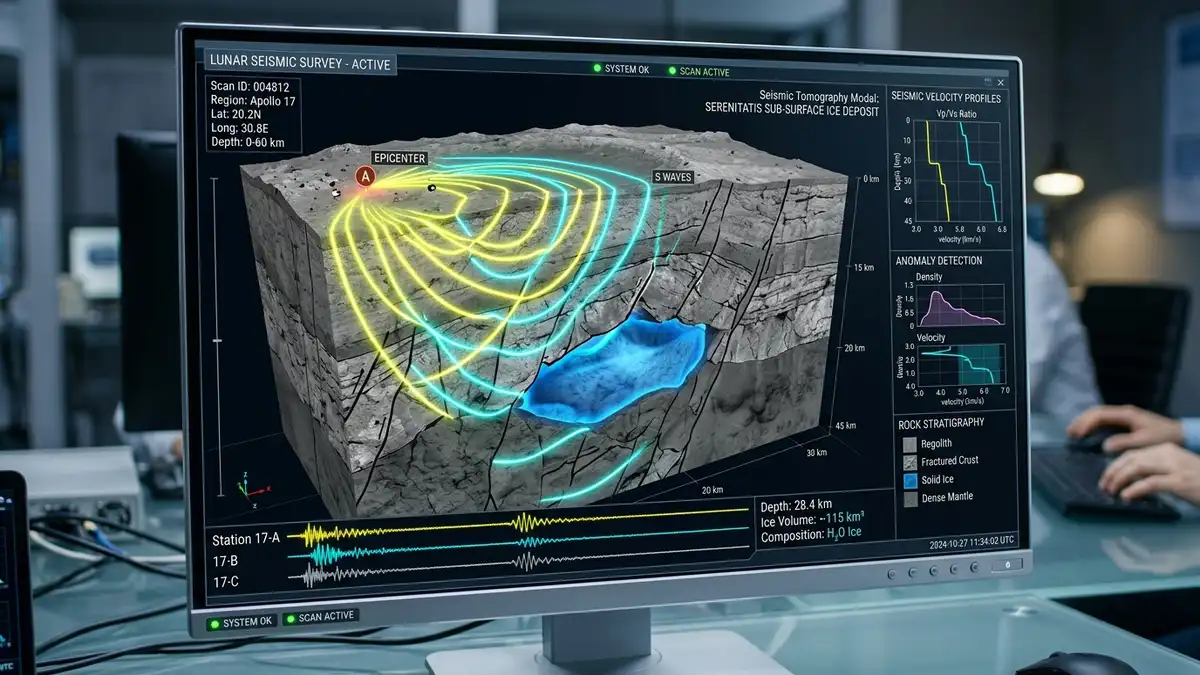
Three-Dimensional Computational Geophysical Model of Seismic Waves

Three-dimensional modeling of seismic waves also helps map lava tubes and underground caverns that offer extra natural protection. These deep geological shelters protect astronauts against extreme temperature fluctuations and destructive micrometeorite showers. Lunar dust, although rich in minerals, is highly sharp and causes severe damage to spacesuits and equipment.

By utilizing the protective structure of these caverns, future lunar bases will be sheltered under hundreds of meters of solid basaltic rock. Installing seismographs allows monitoring the structural integrity of these caverns in real-time before sending civilian crews. Earth's natural satellite ceases to be just a barren desert to transform into a dynamic scientific laboratory.

Integrating new artificial intelligence techniques in seismometers will reduce the energy consumption of equipment at advanced bases. The system will send consolidated data only when it detects relevant tremors or impacts, saving space transmission bandwidth. This automated optimization ensures long-term operational viability in extreme lunar environments.

This advancement represents a paradigm shift in how we conduct geophysical research outside our planet of origin. Lunar seismic mapping is just the first step toward developing sustainable interplanetary infrastructures that will shape the coming decades. These scientific milestones lay the foundation for humanity's permanent presence in the solar system, turning science fiction into tangible reality. The science of our time continues to redefine our relationship with outer space through extremely ingenious research methods.

References and Authoritative Sources #

🏷️ Tags:

📢 Gostou deste artigo?

Compartilhe com seus amigos e nos conte o que você achou nos comentários!

❓Frequently Asked Questions

Seismic waves can detect underground ice because they travel at different speeds through different physical soil densities. Shear waves accelerate very markedly when passing through solid and rigid materials like purified water ice. By tracking the exact travel time of these mechanical vibrations, scientists can create three-dimensional models that differentiate rock from ice hidden beneath the regolith.
The most accepted origin in science is that this water ice was deposited over billions of years by continuous impacts of ancient comets. Since comets have cores composed mostly of water ice and carbon-rich dust, the collisions released water vapor into the lunar vacuum. This vapor slowly migrated to the dark craters of the South Pole, where freezing temperatures kept the compound preserved.
Lunar water ice is the most valuable resource because it can be broken down into hydrogen and oxygen for local rocket fuel manufacturing. Producing propellant directly in space avoids the prohibitive costs of launching hundreds of tons of fuel from Earth's gravity. This facility transforms the Moon into a strategic refueling station for future manned missions to Mars.

Receba novidades!

Cadastre seu email e receba as melhores curiosidades toda semana.

🔒 Sem spam. Cancele quando quiser.

💬 Comentários (0)

Seja o primeiro a comentar! 👋

📚Related Articles

Centennial Encounter: Comet Tempel 2 Makes Its Closest Approach to Earth in 100 YearsScience and Nature

Centennial Encounter: Comet Tempel 2 Makes Its Closest Approach to Earth in 100 Years

The periodic comet 10P/Tempel 2 makes its closest approach to Earth in a century in early August 2026, mobilizing astronomers worldwide.

⏱️5 minLer mais →
Extraterrestrial Geometry: Curiosity Discovers Honeycomb Pattern on Mars SoilScience and Nature

Extraterrestrial Geometry: Curiosity Discovers Honeycomb Pattern on Mars Soil

Fossilized hexagonal mud fractures identified by NASA's Curiosity at Gale Crater provide direct evidence of cyclical wet and dry seasons on ancient Mars.

⏱️6 minLer mais →
Storm Alert: Cold Front Advances and Triggers Extreme Thermal Shock in MSScience and Nature

Storm Alert: Cold Front Advances and Triggers Extreme Thermal Shock in MS

The advance of a subpolar cold air mass collided with the heat of the Pantanal, generating wind gusts of 70 km/h and potential danger alerts in Mato Grosso do Sul.

⏱️5 minLer mais →
James Webb Telescope Shatters Cosmic Record by Detecting JADES-GS-z14-0, the Most Distant Galaxy in the UniverseScience and Nature

James Webb Telescope Shatters Cosmic Record by Detecting JADES-GS-z14-0, the Most Distant Galaxy in the Universe

With a historic redshift z=14.32 and unexpected luminosity 290 million years after the Big Bang, the galaxy reveals oxygen and challenges modern astrophysics.

⏱️6 minLer mais →
NASA’s "Big Bang": The Risky Command That Saved Voyager 2 in Interstellar SpaceScience and Nature

NASA’s "Big Bang": The Risky Command That Saved Voyager 2 in Interstellar Space

Discover how NASA engineers performed an emergency electrical maneuver to extend Voyager 2's lifespan 20 billion km from Earth.

⏱️6 minLer mais →
Rubin Mapping of the COSMOS Field Reveals Unprecedented Details of the UniverseScience and Nature

Rubin Mapping of the COSMOS Field Reveals Unprecedented Details of the Universe

The Vera Rubin Observatory obtains an ultra-deep image of the COSMOS field, mapping over 650,000 galaxies and 50,000 stars.

⏱️6 minLer mais →
Receba novidades no WhatsApp!