Valeriana: PhD Student Discovers Lost Maya Megacity on Page 16 of Google with 6,674 Structures in Mexico
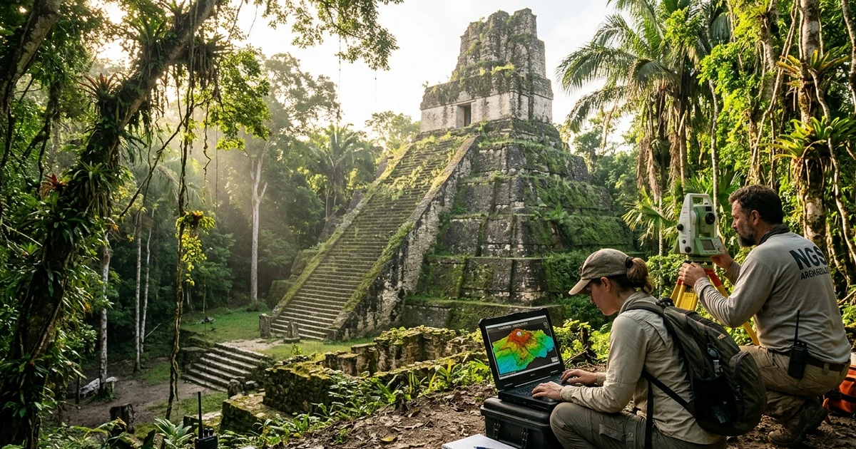
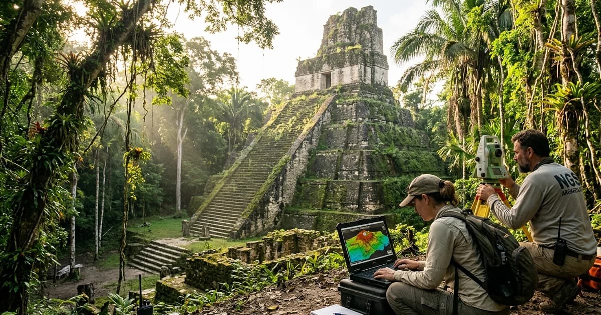
Documentary illustrative recreation based on real research coordinates: archaeologists analyze in the field the 3D elevation map generated by LiDAR beside pyramids and platforms of the newly discovered Maya city of Valeriana, hidden beneath Campeche's jungle canopy, Mexico. (Credit: High-Fidelity Editorial Illustration / Mundo Incrível)
One of modern archaeology's most astonishing breakthroughs began not with machetes hacking through untamed wilderness, but before a standard computer monitor during a routine academic literature search. While browsing through deeply buried internet search pages — specifically around page 16 of Google —, American archaeologist Luke Auld-Thomas, then a doctoral researcher at Tulane University and now a faculty member at Northern Arizona University, stumbled upon an overlooked environmental forestry survey conducted in 2013 across southeastern Mexico. After downloading the raw data files and applying algorithms designed to see through dense foliage, the researcher uncovered Valeriana: a colossal ancient Maya megacity featuring 6,674 pre-Hispanic structures, hidden in plain sight beneath Campeche's rainforest canopy just a fifteen-minute walk from a busy modern federal highway.
The landmark paper formalizing the discovery was published to worldwide acclaim in the prestigious scientific journal Antiquity, published by Cambridge University Press (DOI: 10.15184/aqy.2024.148), titled "Running out of empty space: environmental lidar and the crowded ancient landscape of Campeche, Mexico". Authored by Auld-Thomas alongside veteran anthropologist Marcello A. Canuto, director of Tulane University's Middle American Research Institute, and Adriana Velázquez Morlet, director of the Centro INAH Campeche of Mexico's National Institute of Anthropology and History, the research mapped a continuous survey block of 122 square kilometers. The results demonstrated that Valeriana boasts the second-highest settlement density documented across the entire Classic Maya world, exceeded in urban scale only by the imperial capital of Calakmul.
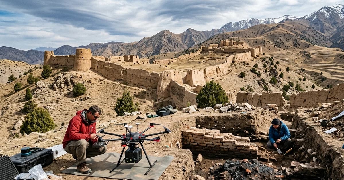
The discovery fundamentally transforms how historians conceptualize the ancient Americas. Much like airborne laser mapping revealed lost Silk Road metropolises thriving at extreme altitudes in Uzbekistan and hidden urban networks along the secret roads of Machu Picchu in the Andes, Valeriana demolishes the centuries-old assumption that Classic Maya centers were isolated islands of civilization set amid untouched jungle. Instead, laser pulses unveiled a heavily modified, interconnected megalopolis where entire ridges were sculpted into residential terraces and valleys were dammed into reservoirs to support between 30,000 and 50,000 inhabitants at its peak between the 8th and 9th centuries CE.
The Google Search Accident: How Forestry Carbon Data Hid a Civilization
The origin story of Valeriana represents one of the most compelling triumphs of open science and methodical curiosity in contemporary research. Around 2020, Luke Auld-Thomas was preparing his doctoral dissertation at Tulane University examining Maya urbanization patterns and urgently required new LiDAR (Light Detection and Ranging) coverage. Because commissioning dedicated research flights with aerial laser scanners can easily exceed hundreds of thousands of dollars, the doctoral student spent weeks testing obscure query variations on Google to locate existing publicly funded laser surveys across Central America.
Digging all the way to page 16 of search results, Auld-Thomas discovered a forgotten environmental airborne survey conducted in 2013 by Mexico's National Forestry Commission (CONAFOR) in partnership with The Nature Conservancy. Flown by the National Center for Airborne Laser Mapping (NCALM) at the University of Houston for the international M-REDD+ initiative (Reducing Emissions from Deforestation and Forest Degradation), the survey's goal was solely to calculate tree canopy volume and forest biomass carbon stocks. The raw ground-return data had been archived on public servers for seven years without an archaeologist ever examining the files.
When Auld-Thomas imported the point-cloud files into Tulane's geospatial laboratory and applied classification filters to strip away the digital forest cover, the dense jungle vanished in minutes. What materialized across the screen was not an unbroken green plain, but a sprawling, continuous ancient urban grid marked by sharp right angles, temple pyramids, public plazas, and causeways that had eluded centuries of explorers and local loggers. The research team formally named the lost metropolis Valeriana, honoring a nearby freshwater lagoon located within that forgotten landscape.
Forensic Technology in the Sky: Stripping 122 Square Kilometers of Jungle
LiDAR technology has accomplished for modern archaeology what the space telescope achieved for astrophysics: making visible what optical physics previously concealed from human sight. In Campeche's subtropical rainforest, vegetation is so impenetrable that a ground expedition walking twenty meters away from a 15-meter-high stone pyramid can pass by without noticing it, fully camouflaged by strangler figs, mahogany roots, and centuries of leaf litter and sediment.
Photon Pulses and the Digital Removal of the Tropical Canopy
The M-REDD+ flight data encompassed a contiguous swath of 122 square kilometers in central-east Campeche, flown in parallel flight lines by twin-engine aircraft several hundred meters above the canopy. Every second, the airborne laser scanner directed hundreds of thousands of infrared light pulses toward the forest. While the vast majority of photons reflected off the upper leaves and branches, a tiny fraction — between 1% and 3% — passed through gaps in the foliage, struck the stone-and-soil ground surface, and returned to the airborne sensor.
From Raw Point Cloud to Digital Elevation Model
The team processed billions of raw laser returns using rigorous algorithmic filtering to separate surface vegetation from genuine ground elevations. The resulting bare-earth Digital Elevation Model (DEM) achieved a spatial resolution of one meter with vertical accuracy under 20 centimeters. Across the 122-square-kilometer block, computer analysis cataloged 6,674 individual pre-Hispanic structures, establishing an extraordinary average density of 55.3 structures per square kilometer — more than four times the rural baseline density across the Maya Lowlands.
Monumental Architecture: Pyramids, a Ballcourt, and the 2-Kilometer Causeway
The densest urban settlement identified within the survey is the ancient metropolis of Valeriana, which spans a continuous residential footprint of 16.6 square kilometers. Rather than an ephemeral camp or scattered hamlets, Valeriana displays all the hallmarks of a major Classic Mesoamerican capital, featuring sophisticated civic planning split between two primary monumental hubs: Valeriana I and Valeriana II.
Valeriana I: The Civic and Sacred Epicenter
The western monumental core, Valeriana I, functioned as the city's political and ceremonial nerve center. At its heart stands a towering temple pyramid rising nearly 15 meters high, surrounded by broad enclosed plazas and aristocratic courtyards framed by multi-room masonry palaces. The architectural stonework displays decorative towers and stepped facades characteristic of the Río Bec style, a refined Maya artistic tradition that flourished in central Yucatán between 600 and 900 CE. Directly adjacent to the central plaza, LiDAR revealed a monumental ballcourt (pitz), the sacred arena where Maya elites reenacted cosmological creation myths and mediated high-stakes geopolitical conflicts.
Valeriana II and Interconnected Sacbeob Causeways
Approximately two kilometers east of Valeriana I lies the second ceremonial core, Valeriana II, constructed atop a naturally fortified limestone ridge. This precinct features administrative colonnades, enclosed audience courtyards, and elite funerary temples encircled by hundreds of residential platforms housing artisans, priests, and military leaders. Connecting both monumental centers and branching outward into surrounding valleys, researchers documented remnants of sacbeob (elevated stone causeways paved with white limestone plaster), which ensured the rapid movement of trade caravans, religious processions, and military contingents throughout summer monsoon floods.
Technical Table: Scientific, Geographic, and Archaeological Parameters of Valeriana
The table below summarizes the architectural, spatial, and chronological parameters published in Antiquity by the Tulane University and INAH Campeche research teams:
| Technical / Archaeological Parameter | Ancient Metropolis of Valeriana | M-REDD+ Total Survey Block | Regional Comparative Context |
|---|---|---|---|
| Geographic Location | East-central Campeche State, Mexico | 122 km² forest block in Yucatán Peninsula | 15 minutes from Federal Highway 186, near Xpujil |
| Urban Settlement Footprint | 16.6 km² of continuous urban occupation | 122 km² total laser survey coverage | Among the largest Classic lowland Maya cities |
| Total Cataloged Structures | 6,674 pre-Hispanic buildings identified | 6,674 architectural features across 122 km² | Average density of 55.3 structures per km² |
| Urban Core Building Density | Hundreds of structures per km² in civic cores | Mean density of 55.3 structures/km² | 2nd densest Maya site in history, behind Calakmul |
| Monumental Architecture | 15-meter temple pyramids, palaces, ballcourt | Two major ceremonial hubs (Valeriana I and II) | Hallmarks of the refined Río Bec architectural tradition |
| Hydraulic Engineering | Dammed reservoir (aguada) with earthen dike | Integrated slope drainage and runoff channels | Stored millions of liters for severe dry seasons |
| Peak Historical Habitation | Late to Terminal Classic (~750 to 850 CE) | Continuous occupation from 250 to 900 CE | Thrived immediately prior to the Classic Maya Collapse |
| Estimated Peak Population | 30,000 to 50,000 inhabitants | Tens of thousands across the wider valley | Rivaled major capitals such as Tikal and Palenque |
| Original Discovery Method | Environmental LiDAR reanalysis by Luke Auld-Thomas | Open forestry data from M-REDD+ (CONAFOR/NCALM) | Found on page 16 of Google academic search results |
| Probable Collapse Cause | Multi-decadal megadroughts, soil exhaustion, warfare | Regional systemic collapse between 800 and 1000 CE | Hyper-dense urban society vulnerable to water failure |
Lowland Hydraulic Engineering: The Reservoir That Sustained 50,000 People
A central question regarding ancient urban life in Campeche centers on water governance. Unlike volcanic highlands or riverine coastal plains, the Yucatán Peninsula is a vast porous limestone karst shelf where rainwater rapidly drains into subterranean aquifers without sustaining permanent surface rivers. To support 30,000 to 50,000 inhabitants, Valeriana's hydraulic engineers engineered massive landscape modifications to capture and store every drop of seasonal precipitation.
Topographic models derived from LiDAR showed that Maya planners transformed the natural drainage basin into an immense water-harvesting system. In a seasonal depression south of Valeriana I, researchers identified a monumental earthen dam built across the valley throat to impound runoff from surrounding slopes. This created an aguada (artificial reservoir) holding millions of liters of freshwater, sufficient to sustain the metropolis through the six-month winter dry season when rainfall ceases across the jungle.
Surrounding the reservoir and extending across adjacent ridges, LiDAR exposed a network of agricultural terraces (bancales) cut into limestone hillsides, flanked by diversion ditches and silt-trapping stone walls. This intensive agricultural landscape provided continuous yields of maize, beans, squash, and amaranth without letting heavy summer downpours strip away fertile topsoil. Much like non-destructive surveys revealed the subterranean burial chambers beneath Petra's Treasury in Jordan, LiDAR demonstrated that Valeriana's builders were master geo-engineers.
The Paradigm Shift and 9th-Century Collapse: Crowding and Megadroughts
Empirical proof that Valeriana reached peak density during the Late Classic period — between 750 and 850 CE — sheds crucial light on the Classic Maya Collapse. For decades, popular theories attributed the civilization's demise to sudden catastrophes, peasant revolts, or invading armies. Valeriana's staggering building density points instead to a grounded ecological explanation: extreme population density colliding with severe climate shifts.
By the early 9th century CE, Valeriana had pushed its agricultural landscape to the limits of ecological carrying capacity, blanketing every habitable ridge with masonry dwellings and terraced fields. Paleoclimate proxy data from lake cores and cave stalagmites confirm that Central America suffered severe multi-decadal megadroughts between 800 and 1000 CE. In an urban center dependent on artificial reservoirs like Valeriana's aguada, consecutive monsoon failures dried up water supplies, collapsed agricultural yields, and triggered famines and warfare between dynasties over dwindling freshwater resources.
In upcoming field campaigns planned by Tulane University and INAH Campeche, archaeologists will conduct the first systematic ground excavations across Valeriana's plazas to analyze pottery stratigraphy, jade and obsidian tools, and ancient DNA. By finding an unknown capital of 6,674 structures on page 16 of Google, Luke Auld-Thomas and Marcello Canuto proved that immense ancient empires remain hidden beneath the jungle canopy — waiting for curious minds to uncover them.
Frequently Asked Questions (FAQ)
How did a graduate student discover the lost Maya city of Valeriana on page 16 of Google?
The landmark discovery occurred when archaeologist Luke Auld-Thomas, then completing his doctorate at Tulane University, browsed deeply into Google search results looking for open-access topographic elevation data covering Mexico. On page 16 of search results, he located an airborne LiDAR survey flown in 2013 by Mexico's National Forestry Commission (CONAFOR) and The Nature Conservancy, originally gathered to monitor forest carbon stocks for the M-REDD+ initiative. By downloading the massive raw dataset covering 122 square kilometers in east-central Campeche and applying specialized archaeological filtering algorithms to strip away the tropical tree canopy, Auld-Thomas uncovered the complete three-dimensional footprint of an unknown ancient metropolis containing 6,674 pre-Hispanic structures preserved intact beneath the vegetation.
What are the primary architectural and urban features identified at Valeriana through airborne LiDAR?
Three-dimensional point-cloud processing revealed that Valeriana spanned a continuous urban footprint of 16.6 square kilometers organized around two monumental civic-ceremonial precincts located approximately two kilometers apart. The primary hub features temple pyramids rising nearly 15 meters high in the refined Río Bec architectural style, expansive enclosed plazas for civic assemblies, elite residential terraces, and a classic court for the Mesoamerican ballgame ritual (pitz). Beyond ceremonial and administrative palaces, the laser maps exposed elevated stone causeways (sacbeob) connecting neighborhoods, extensive hillside agricultural terraces built for intensive farming, and an engineered water reservoir (aguada) formed by an earthen dam that ensured freshwater storage throughout the dry season.
Why does the discovery of Valeriana fundamentally reshape scientific consensus on Maya demographics and collapse?
The discovery of Valeriana decisively shatters the long-held colonial view portraying the Maya Lowlands as an empty jungle wilderness punctuated only by isolated, scattered city-states. With an overall building density of 55.3 structures per square kilometer across the entire surveyed block and concentrations exceeding hundreds of buildings per square kilometer within its core, the site ranks as the second-densest Maya urban settlement ever documented, surpassed only by the superpower of Calakmul. Housing an estimated 30,000 to 50,000 residents between 750 and 850 CE just fifteen minutes on foot from a modern federal highway proves that the Classic Maya collapse struck an intensely engineered, crowded territory where ecological exhaustion and multi-decadal megadroughts crippled deeply interdependent societies.
Official Scientific References and Sources
- Antiquity (Original Research Paper): Auld-Thomas, L., Canuto, M. A., Velázquez Morlet, A., Estrada-Belli, F., Chatelain, D., Matadamas, D., Pigott, M., & Fernandez-Diaz, J. C. — Running out of empty space: environmental lidar and the crowded ancient landscape of Campeche, Mexico (Antiquity, Cambridge University Press, Vol. 98, Issue 401, pp. 1340–1358).
- Tulane University (Middle American Research Institute): Lost Maya city discovered in Mexico by Tulane PhD student.
- Instituto Nacional de Antropología e Historia (INAH México): Estudios de arqueología aérea y LiDAR en la Reserva de la Biosfera de Calakmul y Campeche.
- Smithsonian Magazine: A Graduate Student Found a Vast, Unknown Maya City Hidden Beneath the Jungle Canopy in Mexico.