Laser Drones Reveal Two Lost Silk Road Metropolises at 2,200 Meters Altitude in Uzbekistan
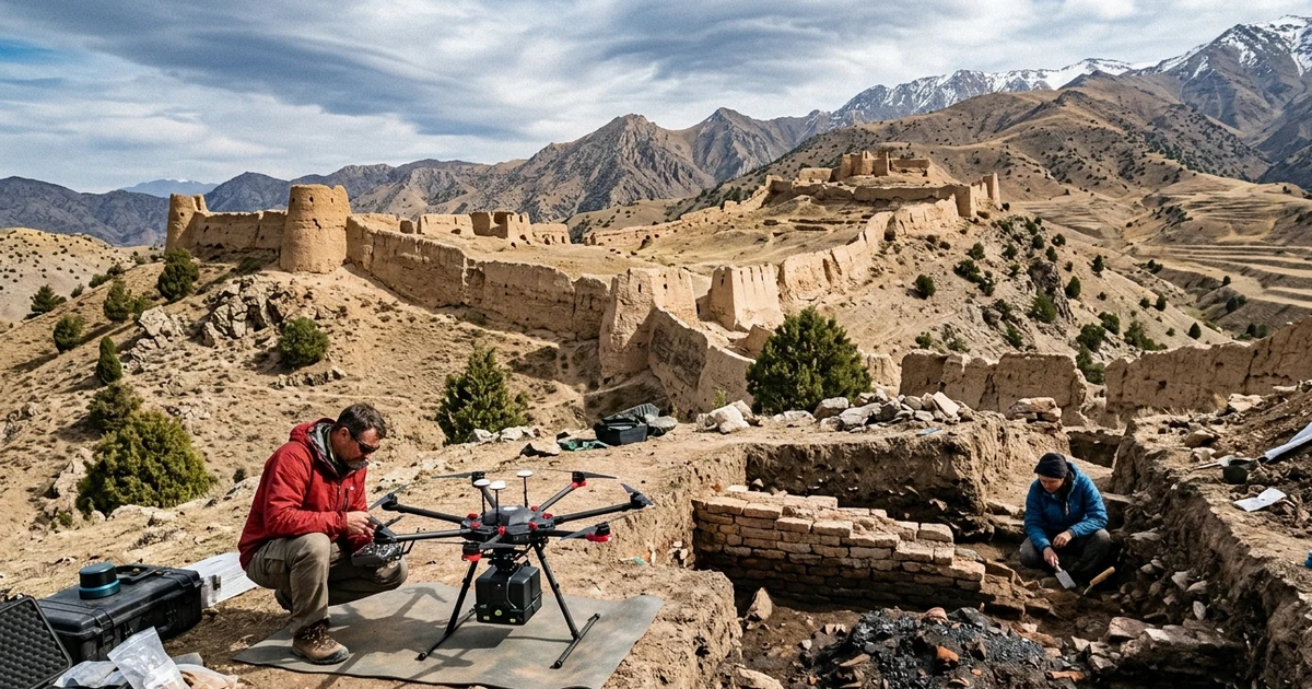
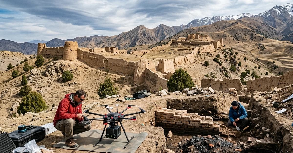
Documentary illustrative recreation based on real expedition data: archaeologists operate a hexacopter drone with a LiDAR sensor above the rammed-earth fortification walls and iron-smelting trenches of Tugunbulak, at 2,200 meters elevation in the Malguzar Mountains, Uzbekistan. (Credit: High-Fidelity Editorial Illustration / Mundo Incrível)
A pioneering remote-sensing laser operation conducted in the mountainous heart of Central Asia has unveiled two fortified medieval metropolises that remained invisible to modern science for nearly a millennium: Tugunbulak and Tashbulak, built between 2,000 and 2,200 meters above sea level in the Malguzar mountain range of southeastern Uzbekistan. Published as a landmark study in the scientific journal Nature under the leadership of archaeologist Michael D. Frachetti of Washington University in St. Louis (WashU) and Farhod Maksudov, director of the National Center of Archaeology of the Academy of Sciences of Uzbekistan, the discovery exposed a colossal urban complex spanning 120 hectares at Tugunbulak — roughly 300 acres containing more than 300 monumental structures — alongside its 12-hectare sister city of Tashbulak. Drone mapping equipped with LiDAR (Light Detection and Ranging) technology and targeted excavations proved that these freezing peaks, situated at an elevation comparable to Machu Picchu in the Peruvian Andes, hosted an industrial civilization that smelted iron and steel on a massive scale to supply the armies and caravans of the Silk Road between the 6th and 11th centuries CE.
For more than a century of orientalist and Soviet historiography, academic consensus held that the Silk Road trade network wound exclusively through fertile lowland oases — linking agricultural metropolises such as Samarkand, Bukhara, Tashkent, and Kashgar — while treating Central Asia's alpine ranges as hostile geographic barriers inhabited only by scattered nomadic herders. The physical revelation of Tugunbulak shatters that premise by demonstrating that pastoralist populations and medieval Turco-Islamic dynasties erected walled citadels, public plazas, terraced neighborhoods, and smelting complexes precisely where strategic resources were concentrated: beside high-purity iron ore veins and alpine juniper forests in the Malguzar range. Today, fewer than 3% of the world's population lives above 2,000 meters elevation, making the existence of an urban industrial powerhouse at this topographic threshold during the Middle Ages one of the most extraordinary archaeological discoveries of the 21st century.
Beyond redrawing the political map of medieval Eurasia, excavations inside Tugunbulak's fortresses delivered the first compelling material proof to solve a geographic enigma that had puzzled historians since the 19th century: the exact location of Marsmanda, the legendary "City of Iron" of the historical province of Ustrushana, celebrated in 10th-century Arabic manuscripts by the geographer Ibn Hawqal. By cross-referencing centimeter-precision three-dimensional point clouds with archaeological trenches that exposed vaulted furnaces and tons of metallurgical slag, the international team reconstructed both the rise and the ecological collapse of a highland empire that shaped the military economy of the Silk Road.
The High-Altitude Enigma and the Mystery of Marsmanda in 10th-Century Manuscripts
To grasp the magnitude of the discovery in the Malguzar Mountains — located in the Zaamin district, roughly 65 kilometers southeast of Jizzakh and northeast of Samarkand — one must examine the gap that separated medieval textual accounts from field archaeology. In 10th-century geographical chronicles of the classical Islamic world, the rugged territory between the Syr Darya river (the ancient Jaxartes) and the Zeravshan river valley was known as the principality of Ustrushana, renowned for its iron, silver, and gold mines as well as the independence of its mountain warriors. The celebrated Arab geographer and chronicler Ibn Hawqal, in his treatise Kitab Surat al-Ard (The Book of the Configuration of the Earth, completed around 977 CE), described with fascination a remarkable settlement in the highlands of Ustrushana named Marsmanda.
According to the testimony preserved by Ibn Hawqal and contemporary Persian geographers of the Balkh school, Marsmanda sat in a climate so cold and elevated that it possessed no gardens, fruit orchards, or vineyards, contrasting starkly with the irrigated lowland oases of Transoxiana. Despite harsh winters that buried the slopes in deep snow for months, the chronicler reported that the city boasted crystal-clear running streams, summer pastures of unmatched beauty, and a massive monthly market where merchants from distant lands traded tens of thousands of dinars for locally forged weapons, tools, and ingots of iron and steel. For decades, archaeologists searched the low valleys of Uzbekistan and Tajikistan for the ruins of Marsmanda, never suspecting that an entire metropolis lay camouflaged across wind-scoured ridges above 2,000 meters.
The first concrete clue emerged in 2011, when Michael D. Frachetti and Farhod Maksudov hiked across the alpine ridges of the Zaamin forestry reserve and encountered glazed pottery shards, coins, and a medieval necropolis at the site of Tashbulak, at 2,100 meters elevation. Four years later, in 2015, a local forestry inspector patrolling the mountains just five kilometers away alerted the researchers that he had found identical ceramic fragments in the backyard of his mountain station, in an area known as Tugunbulak. When Frachetti and Maksudov climbed to the site, they realized that gentle mounds covered in dry steppe grass and thorny shrubs stretched across kilometers of ridges and valleys, yet the sheer scale of the terrain and a thousand years of severe erosion made it impossible to tell with the naked eye where the natural mountain ended and human fortifications began.
Forensic Revolution in the Sky: How 22 Drone Flights with LiDAR Stripped the Malguzar Mountains
Mapping an eroded metropolis spanning more than a square kilometer across rugged mountain topography required technology capable of seeing through surface vegetation and detecting micro-topographic variations of just a few centimeters. Much like the geophysical breakthrough that revealed the secret subterranean tomb beneath the Treasury at Petra in Jordan and the subsurface surveys at the Durupınar Formation near Mount Ararat, modern archaeology relies on ultra-precise non-destructive sensors, yet Uzbekistan presented a formidable logistical hurdle: strict national security laws tightly regulate manned aircraft and drone operations in its airspace. Years of diplomatic and scientific collaboration were required before the Academy of Sciences of Uzbekistan and government authorities granted special clearance for the first archaeological UAV-LiDAR (uncrewed aerial vehicle LiDAR) campaign ever conducted in Central Asia.
GeoSLAM Laser Instrumentation and Sub-Meter Photogrammetry
Between June 5 and June 22, 2022, the field team operated across the slopes of Malguzar using a heavy-lift DJI Matrice 600 Pro hexacopter drone equipped with a rotating GeoSLAM Zeb Horizon laser scanner, complemented by DJI Phantom 4 RTK drones dedicated to high-resolution aerial photogrammetry. Across 22 flight missions over Tugunbulak (covering a total polygon of 165 hectares) and additional flights over Tashbulak (covering 25 hectares), the LiDAR sensor fired hundreds of thousands of laser pulses per second at the alpine ground, measuring the exact return time of each reflected photon. Because laser pulses penetrate between blades of steppe grass and low scrub, researchers digitally stripped away all surface biomass to generate Digital Terrain Models (DTMs) with an extraordinary spatial resolution of 15 to 25 centimeters per pixel.
Computer-Vision Algorithms and Micro-Topographic Skeletonization
The raw point cloud generated by the 22 flights revealed a landscape so densely carved with trenches, terraces, and buried ramparts that manual tracing would have required more than a decade of technical drafting. To decode this urban fabric, Frachetti partnered with computer scientists Tao Ju, Xiaoyi Liu, and Jack Berner at Washington University's McKelvey School of Engineering, who developed a novel computational geometry algorithm designed for the "skeletonization" of micro-topographic ridges. The software automatically analyzed three-dimensional terrain curvature gradients, linking subtle linear elevations left by collapsed walls of rammed earth (pakhsa) and stone masonry to trace the exact architectural blueprint of more than 300 individual structures across Tugunbulak.
Anatomy of Two Cities in the Clouds: The Military and Urban Architecture of Tugunbulak and Tashbulak
The three-dimensional maps published in Nature astonished the global archaeological community with the monumental scale and sophisticated defensive planning of both cities. Far from being seasonal tent encampments or improvised mountain outposts, Tugunbulak and Tashbulak exhibit permanent architecture adapted to steep slopes between 2,000 and 2,200 meters elevation, blending building traditions from Transoxiana's oasis metropolises with the strategic mastery of rocky ridgelines practiced by steppe nomads.
Tugunbulak: The 120-Hectare Metropolis and Five Interconnected Fortresses
With a continuous urbanized footprint of approximately 120 hectares, Tugunbulak commanded the mountain passes connecting the Fergana Valley and the Tashkent basin to the heartland of Samarkand. LiDAR scanning revealed that the metropolis was shielded by an extensive network of outer defensive ramparts built along steep ridgelines, punctuated by circular and rectangular watchtowers that visually controlled every valley approach. Inside this fortified perimeter, the city was organized around an elevated central citadel and five massive fortified complexes (resembling interconnected castles), alongside hundreds of stepped residential terraces, open caravan plazas, and snowmelt water reservoirs.
Tashbulak: The 12-Hectare Sister City and Its Early Islamic Necropolis
Located just five kilometers west of Tugunbulak at roughly 2,100 meters elevation, Tashbulak covered approximately 12 hectares — one-tenth the size of its giant neighbor — while serving a complementary residential, administrative, and religious role in the highland network. The laser map of Tashbulak highlighted a commanding artificial mound citadel (tepe), dozens of densely clustered dwellings, retaining walls, and a vast necropolis containing at least 400 burials aligned according to early Islamic funerary rites. Unlike Tugunbulak, Tashbulak lacked large-scale industrial smelting complexes, functioning instead as a civic, residential, and ceremonial hub integrated into the mountain range's metropolitan economy.
Technical Table: Archaeological, Geophysical, and Historical Parameters of Tugunbulak and Tashbulak
The table below synthesizes the quantitative, technological, and chronological data consolidated by the study published in Nature (DOI: 10.1038/s41586-024-08086-5) and the field campaigns of Washington University in St. Louis and the National Center of Archaeology of Uzbekistan:
| Technical / Historical Parameter | Metropolis of Tugunbulak | City of Tashbulak | Scientific & Comparative Context |
|---|---|---|---|
| Geographic Location | Malguzar Mountains (Zaamin, Southeastern Uzbekistan) | Malguzar Mountains (5 km west of Tugunbulak) | Historical medieval province of Ustrushana (65 km from Jizzakh) |
| Elevation Above Sea Level | 2,000 to 2,200 meters | ~2,100 meters | Comparable to Machu Picchu (2,430 m); zone inhabited by <3% of humanity |
| Mapped Urban Area | Tugunbulak was roughly half the area of medieval Samarkand | ||
| Occupation Period (Radiocarbon) | 6th to early 11th century CE (~550–1050 CE) | 8th to early 11th century CE (~730–1050 CE) | Peak expansion under the Qarakhanid Empire |
| Detected Architectural Structures | Over 300 buildings, 5 fortresses, citadel, and ridge walls | Nearly 100 structures, central citadel, and 400-tomb necropolis | Built of rammed earth (pakhsa), mudbrick, and stone foundations |
| Aerial Mapping Technology | 22 DJI Matrice 600 Pro drone flights + GeoSLAM Zeb Horizon LiDAR | UAV-LiDAR drone flights + DJI Phantom 4 RTK photogrammetry | Digital Terrain Model (DTM) resolution of 15 to 25 cm/pixel |
| Computational Processing | Micro-topographic skeletonization algorithm (Tao Ju, Xiaoyi Liu, Jack Berner) | Point-cloud classification and ground magnetometry (Edward Henry) | Reduced decades of manual surveying to weeks of computational analysis |
| Primary Economic Activity | Heavy industrial metallurgy (iron ore smelting and steel forging) | Caravan trade, administration, alpine pastoralism, and religious center | Strong physical match for Ibn Hawqal's legendary Marsmanda |
| Probable Cause of Abandonment | Severe deforestation of juniper (Juniperus) forests and political shifts | Collapse of the regional highland economic network in the early 11th century | Charcoal fuel depletion rendered high-temperature furnaces unsustainable |
The "City of Iron" of the Qarakhanid Nomads: Industrial Steelmaking at 2,200 Meters
To verify what lay beneath the geometric anomalies flagged by the computer algorithm, archaeologists opened targeted excavation trenches inside one of Tugunbulak's five large fortified compounds — a monumental structure protected by thick rammed-earth (pakhsa) walls and limestone foundations. What emerged from the stratigraphic layers was not an idle palace complex, but a medieval metallurgical factory preserved in situ. Researchers unearthed vaulted refractory-brick smelting furnaces, air-draft channels (tuyères), charcoal storage pits, and dense strata of vitrified black slag left by high-temperature iron ore reduction.
Building an industrial metropolis at 2,200 meters elevation followed a brilliant thermodynamic and logistical engineering logic. The Malguzar Mountains contain rich surface veins of hematite and magnetite ore, while their slopes were covered during the Middle Ages by dense forests of Turkestan juniper (Juniperus seravschanica and Juniperus semiglobosa), a dense, resinous wood that yields charcoal of exceptional calorific output. Furthermore, fierce, steady winds funneled through the alpine canyons acted as natural bellows to supercharge furnace combustion, enabling metallurgists to reach the critical temperatures required to smelt iron and forge high-carbon steel (including crucible steel variants prized across the Islamic world).
Under the rule of the Qarakhanid Empire (999–1212 CE) — the first major Turkic dynasty of nomadic origin in Central Asia to officially embrace Islam and govern both the steppes and the lowland metropolises of Bukhara and Samarkand — controlling steel production at Tugunbulak was the key to military and economic supremacy. From its mountain workshops flowed curved sabers, spearheads, arrowheads, chainmail, horseshoes for thousands of warhorses, and agricultural plowshares that moved down mountain trails into the markets of Transoxiana, Persia, and Tang and Song China. The discovery proves that populations historically labeled as "pastoral nomads" were not mere raiders or passive middlemen for lowland caravans, but urban engineers and industrial producers who dictated the terms of Silk Road commerce.
The 11th-Century Ecological Collapse and Rewriting Silk Road History
Just as dramatic as its rise, the sudden disappearance of Tugunbulak and Tashbulak during the first half of the 11th century CE offers a sobering historical lesson on the environmental limits of pre-modern industrialization. No evidence of catastrophic destruction by foreign invasion — such as the Mongol campaigns of Genghis Khan, which occurred nearly two centuries later in the 1220s — was found in the final occupation layers of either city. Instead, geoarchaeological and paleoenvironmental analyses point to an energy sustainability crisis triggered by the very success of the local iron industry.
Producing a single ton of forged iron in medieval furnaces required burning several tons of wood charcoal harvested from extremely slow-growing juniper trees on slopes above 2,000 meters. After four to five centuries of relentless logging to feed hundreds of industrial kilns and heat an urban population of thousands through freezing mountain winters, the forests of Malguzar suffered severe deforestation. Without forest cover to retain snowpack and stabilize steep hillsides, mountain stream hydrology shifted dramatically, slope erosion accelerated, and the cost of hauling fuel from increasingly distant valleys made smelting economically unviable, leading to the evacuation of the metropolises and their slow reabsorption into the alpine steppe.
In upcoming field seasons planned by Michael D. Frachetti and Farhod Maksudov, the joint mission aims to expand excavations into Tugunbulak's central citadel and apply metallographic and isotopic analyses to slag and steel artifacts, tracing which battlefields and Eurasian markets received blades forged in Malguzar. By demonstrating that drone-mounted LiDAR and computer vision can reveal 120-hectare cities where only empty pastures were previously visible, the discovery of Tugunbulak and Tashbulak inaugurates a new era in mountain archaeology — proving that the industrial heart of the Silk Road beat above the clouds.
Frequently Asked Questions (FAQ)
How did archaeologists discover the lost cities of Tugunbulak and Tashbulak in the mountains of Uzbekistan?
The discovery and comprehensive mapping of the two medieval metropolises were achieved by a joint mission led by Professor Michael D. Frachetti of Washington University in St. Louis and Farhod Maksudov, director of the National Center of Archaeology of the Academy of Sciences of Uzbekistan, through the first drone-mounted LiDAR survey ever conducted in Central Asia. Over three weeks of intensive fieldwork in the Malguzar Mountains, the researchers flew 22 missions using a heavy-lift DJI Matrice 600 Pro hexacopter equipped with a GeoSLAM Zeb Horizon laser scanner, covering 165 hectares at Tugunbulak and 25 hectares at Tashbulak. The laser pulses penetrated the alpine steppe grass and, combined with computer-vision algorithms developed by Tao Ju and Xiaoyi Liu, revealed at 15-to-25-centimeter resolution more than 300 buildings, defensive walls, watchtowers, and subterranean smelting furnaces that centuries of erosion had disguised as natural hills.
Why do historians link the metropolis of Tugunbulak to the legendary City of Iron known as Marsmanda?
The direct connection between the archaeological complex of Tugunbulak and the ancient city of Marsmanda stems from the extraordinary convergence between physical excavation findings and 10th-century Arabic and Persian geographical chronicles, particularly the classic treatise Kitab Surat al-Ard written by the chronicler and traveler Ibn Hawqal. In medieval manuscripts describing the historical province of Ustrushana, Marsmanda was portrayed as a bustling commercial and metallurgical center perched in freezing mountains, devoid of orchards or vineyards due to the harsh cold, yet surrounded by lush alpine pastures, crystal-clear streams, and ironworks that attracted weapons merchants from across Eurasia. When the archaeological team excavated inside one of Tugunbulak's five fortified castles at 2,200 meters elevation, they uncovered thick strata of black iron slag, vaulted smelting kilns, and juniper charcoal, proving industrial-scale metallurgy that converted local mountain ore into high-carbon steel and weaponry.
What caused the collapse and final abandonment of these fortified Silk Road cities in the 11th century?
Radiocarbon dating of organic samples and wood charcoal indicates that both Tugunbulak and Tashbulak flourished between the 6th and 11th centuries CE, reaching their urban and industrial zenith under the Qarakhanid Empire before being abruptly abandoned during the first half of the 11th century. While shifting geopolitical alliances and military conflicts along Central Asian trade routes contributed to regional instability, archaeobotanical evidence points to a severe ecological collapse triggered by the very iron and steel industry that made the metropolis wealthy. To keep hundreds of metallurgical furnaces burning at extreme temperatures across several centuries, smelters exhaustively logged the dense native juniper forests of the Malguzar slopes, depleting the essential wood fuel required for forging steel and triggering soil erosion that made sustaining a dense urban population at extreme altitude impossible.
Official Scientific References and Sources
- Nature (Original Research Paper): Frachetti, M. D., Berner, J., Liu, X., Henry, E. R., Maksudov, F., & Ju, T. — Large-scale medieval urbanism traced by UAV–lidar in highland Central Asia (DOI:
10.1038/s41586-024-08086-5). - Washington University in St. Louis (WashU): Lost Silk Road cities uncovered in mountains of Uzbekistan using drone LiDAR.
- Colorado State University (CSU): Archaeologists map lost medieval cities in Central Asia using drone-based LiDAR and geophysics.
- Smithsonian Magazine: Archaeologists Discover Two Lost Silk Road Cities High in the Mountains of Uzbekistan.