🌍 Your knowledge portal
ciencia-natureza

NASA Confirms Uhackatik Impact Crater in Quebec, Canada

📅 2026-09-21🔄 Updated: 2026-10-12⏱️ 7 min read📝
NASA Confirms Uhackatik Impact Crater in Quebec, Canada
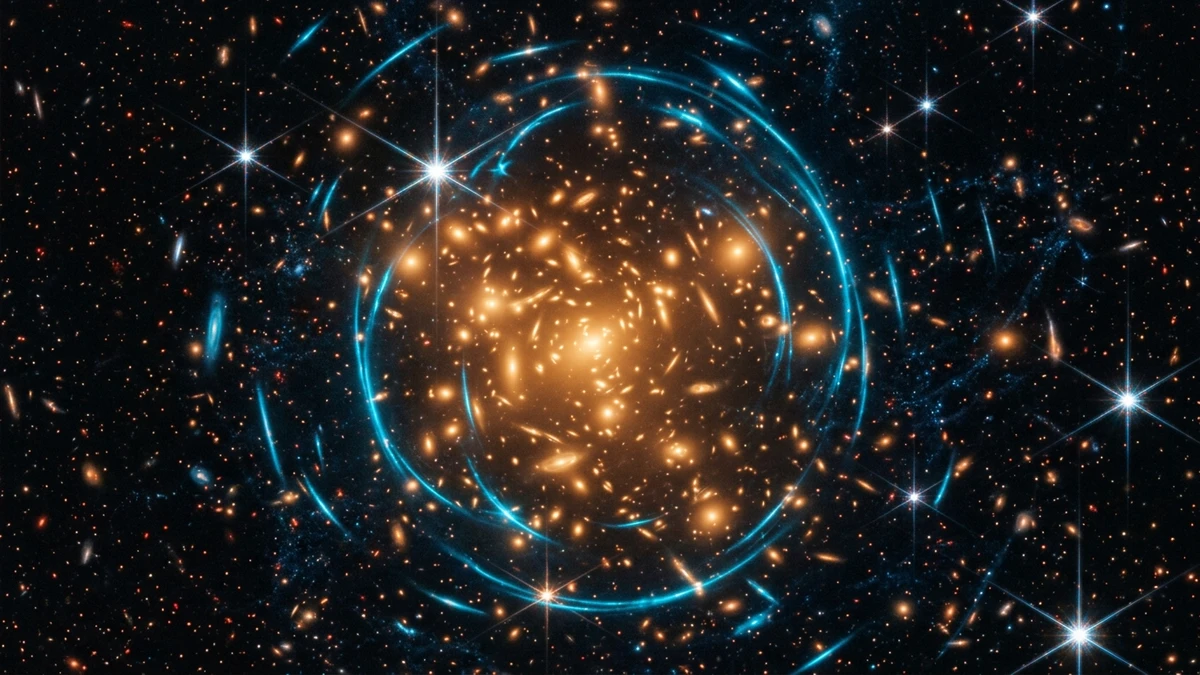
NASA Confirms Uhackatik Impact Crater in Quebec, Canada — High-Fidelity Artistic Illustration created by artificial intelligence based on scientific research.
⚡

Quick Summary

NASA and Western University geologists confirm the discovery of the 25-kilometer Uhackatik impact crater formed during the Devonian in Quebec. Scientists from Western University, in collaboration with the European Centre for Research and Teaching in Environmental Geosciences (CEREGE) and analysts from the NASA Earth Observatory, officially confirmed the discovery of the Uhackatik impact crater in September 2026.

Key Takeaways:

  • The investigative chain that uncovered Uhackatik underscores the transformative potential of democratized satellite imagery.
  • In planetary geology, validating an impact structure cannot rely solely on circular terrain morphology, since volcanic calderas, salt diapirs, and sinkhole collapses frequently mimic circular outlines.
  • The following structured table contrasts the physical, chronological, and energetic parameters of Uhackatik with renowned impact structures worldwide.

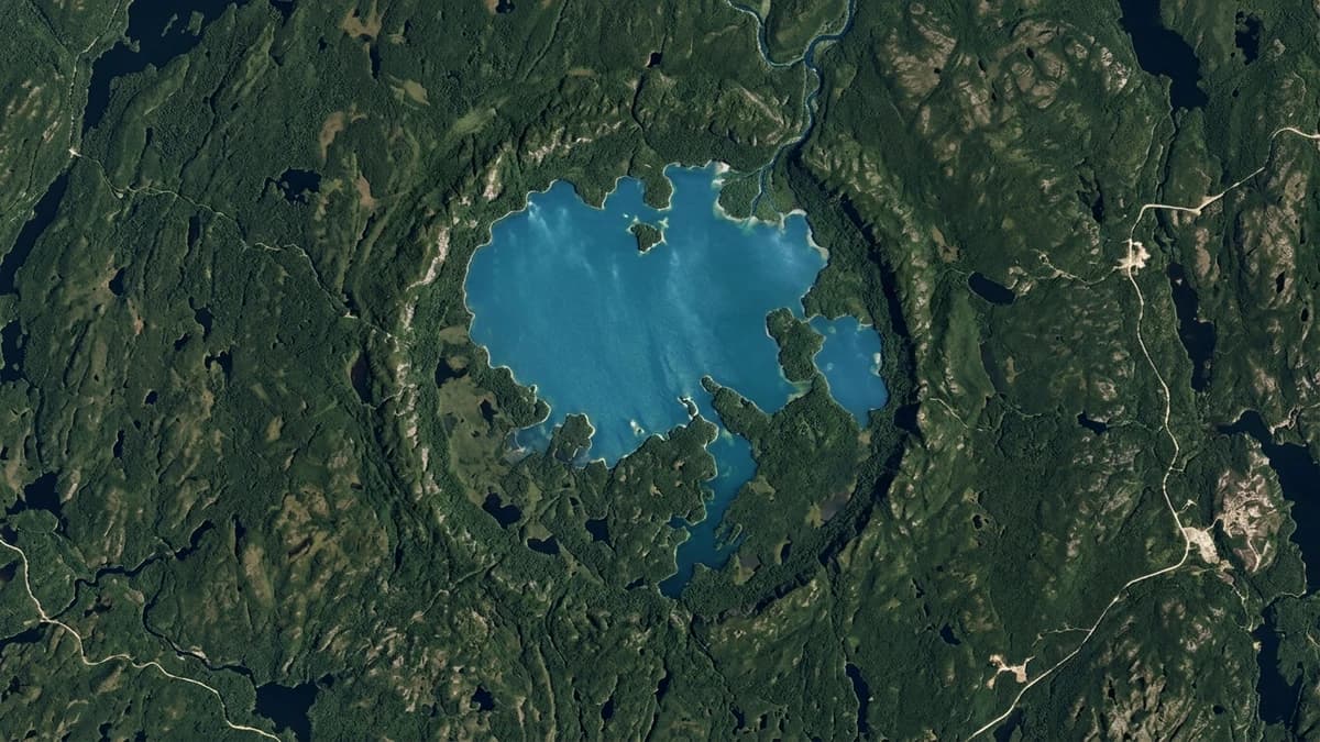
Scientists from Western University, in collaboration with the European Centre for Research and Teaching in Environmental Geosciences (CEREGE) and analysts from the NASA Earth Observatory, officially confirmed the discovery of the Uhackatik impact crater in September 2026. Spanning 25 kilometers across the Canadian Shield around Lake Marsal in the Côte-Nord territory of Quebec, this massive impact scar was gouged into Earth's crust approximately 390 million years ago during the Middle Devonian epoch. The ancient cosmic scar remained concealed beneath dense boreal forest cover until orbital remote sensing detected its ring topography, subsequently verified through field petrographic analysis of hypervelocity shock metamorphism.

The discovery represents one of the most remarkable accomplishments in modern citizen science applied to planetary geology. Amateur observer Joël Lapointe first spotted the concentric mountain ring while browsing high-resolution satellite imagery on Google Earth to plan a camping trip. Lapointe forwarded the coordinates to planetary geologist Gordon Osinski, prompting an in-situ expedition that collected bedrock samples bearing diagnostic planar deformation features and shatter cones. These findings ruled out terrestrial volcanic calderas or differential glacial erosion, confirming hypervelocity asteroid impact origins.

NASA formally validated the structure through multispectral and thermal imagery captured by the Landsat 8 and Landsat 9 satellites. Following formal consultations with the Tribal Council of the Innu Nation of Ekuanitshit, the geological feature was officially christened Uhackatik, honoring the ancestral stewards of the Côte-Nord territory. Cataloged among Earth's verified meteorite craters, Uhackatik provides an accessible terrestrial proving ground to calibrate hydrodynamic impact physics models and evaluate cosmic collision hazards facing planetary biospheres.
The Discovery of Uhackatik: From Citizen Science to NASA Verification #

The investigative chain that uncovered Uhackatik underscores the transformative potential of democratized satellite imagery. While examining satellite layers in Google Earth, Joël Lapointe noticed that Lake Marsal exhibited an unusual curved shoreline aligned along a continuous circular mountain arc twenty-five kilometers across, flanked by radial drainage canyons. Within a regional landscape dominated by linear northeast-southwest glacial scouring, this concentric ring stood out as an anomaly within the Grenville geological province.

Recognizing its geometric peculiarity, Lapointe submitted his observations to the Institute for Earth and Space Exploration at Western University. Professor Gordon Osinski and French geochemist Pierre Rochette conducted preliminary screening by combining Shuttle Radar Topography Mission (SRTM) digital elevation data with Canadian aeromagnetic surveys. The geophysical data revealed a distinct circular magnetic low centered on the lake, indicative of thermal demagnetization produced by high-energy shock waves.

Encouraged by these geophysical signatures, an expedition team conducted systematic sampling along riverbanks and exposed rock ridges. Recovering specimens displaying diagnostic shock fractures and impact melt rocks allowed researchers to present their findings to NASA's Earth observation division. On September 21, 2026, the NASA Earth Observatory issued a technical bulletin documenting the crater's morphology, marking the successful collaboration between sharp-eyed amateur observation and professional planetary geoscience.

Diagnostic Petrographic Evidence: Shatter Cones and Shocked Quartz #

In planetary geology, validating an impact structure cannot rely solely on circular terrain morphology, since volcanic calderas, salt diapirs, and sinkhole collapses frequently mimic circular outlines. Unequivocal scientific verification requires identifying established microscopic and macroscopic shock indicators produced exclusively by dynamic shock pressures exceeding hundreds of thousands of atmospheres.

Across exposed cliffs surrounding Lake Marsal, geologists documented dozens of well-developed shatter cones etched into anorthosite and felsic gneiss bedrock. These conical fracture features exhibit radiating, striated grooves that diverge outward from an apex pointing directly toward the focal origin where the impactor struck at hypervelocity. Generating shatter cones requires transient dynamic shock pressures between 2 and 10 gigapascals—conditions that volcanic explosions and tectonic faulting cannot generate.

In thin-section petrographic analysis under cross-polarized light microscopy and scanning electron microscopy, quartz grains revealed intersecting sets of planar deformation features (PDFs). These parallel, sub-microscopic glass lamellae form when the crystalline silica lattice collapses under shock pressures between 10 and 35 gigapascals. The discovery of pseudotachylyte veins—friction melt rock produced along fault planes during impact collapse—confirmed that Uhackatik is an authentic meteorite crater.

Comparative Structural Parameters of Major Terrestrial Impact Craters #

The following structured table contrasts the physical, chronological, and energetic parameters of Uhackatik with renowned impact structures worldwide.

Geological / Geophysical Metric Uhackatik Impact Crater (Quebec) Manicouagan Crater (Eye of Quebec) Chicxulub Impact Crater (Yucatán) Analytical Methodology Applied
Rim Diameter 25 kilometers across 85–100 kilometers across 180–200 kilometers across Orbital LiDAR & satellite altimetry
Estimated Age ~390 million years (Devonian) ~214 million years (Late Triassic) ~66 million years (Cretaceous-Paleogene) High-precision ⁴⁰Ar/³⁹Ar isotopic dating
Impactor Diameter 1.2 to 1.8 kilometers ~5 kilometers across ~10 to 12 kilometers across Hydrodynamic reverse simulation
Melt Sheet Thickness Exceeds 50 meters on exposed ridges Up to 200 meters of impact melt rocks Deep subterranean melt sheet Geological profiling & ground radar
Diagnostic Shock Minerals Planar deformation features & shatter cones Coesite, stishovite, maskelynite Shocked quartz & global iridium layer Polarized light petrography & SEM

The data confirms that while smaller than the catastrophic Chicxulub dinosaur-extinction event, Uhackatik ranks among the best-preserved medium-scale craters on the Canadian Shield, offering accessible impact melt exposures for scientific study.

Collision Dynamics: Kinetic Energy and the Devonian Transient Basin #

Hydrodynamic computer simulations modeling the Uhackatik event indicate that an asteroid measuring over one kilometer in diameter entered the atmosphere at roughly twenty kilometers per second (over seventy thousand kilometers per hour). The kinetic energy released upon impact exceeded hundreds of thousands of megatons of TNT equivalent, dwarfing the combined yield of thousands of nuclear detonations.

The hypervelocity impact excavated a transient cavity four kilometers deep within ten seconds, vaporizing the bolide and shattering crustal rock under shock pressures exceeding fifty gigapascals. The initial deep bowl subsequently collapsed under gravity, triggering hydrodynamic rebound that pushed up a central peak surrounded by concentric ring grabens, transforming the cavity into a complex multi-ring basin.

The vapor plume ejected billions of tons of pulverized rock and silica-rich aerosols into the stratosphere. Occurring during the Middle Devonian epoch—a period when early terrestrial forests and primitive amphibians were establishing themselves on land—paleontologists are currently investigating whether atmospheric dusting and wildfires linked to Uhackatik contributed to biotic crises documented in the fossil record.

Glacial Shielding and Lake Marsal's Modern Topography #

Preserving a 390-million-year-old crater on Earth is a rare geological outcome. On geologically inactive worlds like the Moon and Mercury, craters persist for billions of years without alteration. On Earth, tectonic plate motion, fluvial weathering, and sedimentary burial typically erase or conceal surface scars within tens of millions of years.

At Uhackatik, the stability of the Grenville geological province—an ancient cratonic core that experienced no major mountain-building events since the Paleozoic—shielded the bedrock from disruption. While successive Pleistocene ice sheets scraped away the upper rim and eroded the central peak, Lake Marsal formed within the annular ring graben, where brecciated and weakened rock was scoured out by glacial action.

The alternating landscape of serene lakes and forested ridges reflects the underlying ring fault geometry forged during the cosmic impact. The modern Magpie River drainage basin flows through these concentric depressions, creating a boreal ecosystem whose hydrology follows structural fault lines created by an asteroid that struck long before the appearance of dinosaurs.

Planetary Defense Implications and Lunar Exploration Analogs #

Studying terrestrial structures like Uhackatik provides physical benchmarks essential for calibrating planetary defense initiatives managed by NASA and ESA. Deflection strategies tested by kinetic impact experiments, such as NASA's DART mission, depend on scaling equations that convert projectile mass, velocity, and density into cratering volume and kinetic momentum transfer. Analyzing in-situ impact melt sheets and shock fractures on Earth validates theoretical models against physical evidence.

Beyond planetary defense, the crater serves as an analog training environment for astronauts and geologists preparing for upcoming Artemis missions to the Moon and crewed voyages to Mars. Developing visual proficiency in identifying shatter cones and distinguishing impact melt sheets from volcanic basalt flows is a vital field skill for lunar sample collection. Western University frequently deploys autonomous rover testbeds across the rugged terrain of Lake Marsal to evaluate navigation algorithms on complex fractured bedrock.

Future scientific initiatives scheduled for Lake Marsal include deep core drilling to recover subsurface melt sheets and high-precision argon-argon (⁴⁰Ar/³⁹Ar) geochronology. Confirming Uhackatik stands as a monument to planetary discovery, demonstrating that curious citizen observers, combined with modern satellite surveillance, continue to reveal deep cosmic chapters in Earth's history.

Official Planetary Science References and Technical Documentation #

🏷️ Tags:

#Uhackatikcrater#Quebecimpactcrater2026#NASAEarthObservatory#GordonOsinski#asteroidcraterCanada#planetarygeology

📢 Gostou deste artigo?

Compartilhe com seus amigos e nos conte o que você achou nos comentários!

❓Frequently Asked Questions

Quebec resident Joël Lapointe was conducting routine satellite reconnaissance using the Google Earth mapping platform to scout potential fishing and wilderness camping locations around Lake Marsal in Quebec's remote Côte-Nord region. Upon magnifying shaded digital elevation models, Lapointe noticed a striking, nearly perfect circular depression spanning twenty-five kilometers across, bordered by anomalous curved ridges that contrasted sharply with the regional landscape. Suspecting an uncataloged cosmic impact structure rather than standard volcanic topography, Lapointe contacted planetary geologist Gordon Osinski at Western University, providing precise geographic coordinates that prompted university researchers to organize the first field geological expedition to collect rock specimens.
Unequivocal scientific confirmation of a cosmic impact crater requires identifying shock metamorphism signatures produced solely by transient ultra-high pressures exceeding thousands of atmospheres, which normal volcanic or tectonic events cannot generate. Rock samples of anorthosite and granitic gneiss collected by the field research expedition exhibited distinct shatter cones with divergent, striate fractures formed by shock waves exceeding two gigapascals. Subsequent petrographic examination under polarized light microscopy and scanning electron microscopes revealed multiple intersecting sets of planar deformation features (PDFs) within quartz crystals, accompanied by polymict impact breccias and pseudotachylyte friction melt veins formed by the instantaneous flash melting of the continental crust.
The designation Uhackatik was conferred through a formal collaborative initiative between planetary researchers at Western University and the Band Council of the Innu Nation of Ekuanitshit, whose ancestral territory encompasses the Lake Marsal watershed. In the indigenous Innu-aimun language, the term Uhackatik geographically denotes mountains encircled by serene waters and bending rivers, describing the physical circular topography of the ring hills surrounding the lake. The Geographical Names Board of Canada and the NASA Earth Observatory formally adopted this indigenous name, establishing an ethical standard for integrating native traditional cultural heritage with cutting-edge international earth observation science.

Receba novidades!

Cadastre seu email e receba as melhores curiosidades toda semana.

🔒 Sem spam. Cancele quando quiser.

💬 Comentários (0)

Seja o primeiro a comentar! 👋

📚Related Articles

James Webb Confirms Most Distant Gravitational Lens in Universe at Galaxy Cluster XLSSC 122ciencia-natureza

James Webb Confirms Most Distant Gravitational Lens in Universe at Galaxy Cluster XLSSC 122

At 10.4 billion light-years, JWST measures strong gravitational lensing around ultra-dense cluster XLSSC 122, testing early dark matter halo distribution models.

⏱️7 minLer mais →
Covid-19 Years Later: Scientific Consensus on Long Covid Complications and Global Vaccine Impactciencia-natureza

Covid-19 Years Later: Scientific Consensus on Long Covid Complications and Global Vaccine Impact

Peer-reviewed data synthesizes long-term Long Covid pathology, global excess mortality audits, and real-world vaccination protection metrics years after pandemic onset.

⏱️8 minLer mais →
James Webb Reveals Host Galaxy of Farthest Fast Radio Burstciencia-natureza

James Webb Reveals Host Galaxy of Farthest Fast Radio Burst

The James Webb Space Telescope identifies the host galaxy of the most distant fast radio burst ever recorded, emitted 10 billion years ago.

⏱️6 minLer mais →
2026 Nobel Prize in Physics Reveals Secret of Cosmic Neutrinosciencia-natureza

2026 Nobel Prize in Physics Reveals Secret of Cosmic Neutrinos

Physicist Francis Halzen wins the 2026 Nobel Prize in Physics for leading the IceCube Observatory and detecting deep space ghost particles.

⏱️6 minLer mais →
2026 Nobel Prize in Chemistry Reveals Secret of Origin of Lifeciencia-natureza

2026 Nobel Prize in Chemistry Reveals Secret of Origin of Life

Scientists Henri Kagan and Kenso Soai win the 2026 Nobel Prize in Chemistry for solving the molecular homochirality enigma that birthed life.

⏱️6 minLer mais →
James Webb Telescope Reveals Secrets of Stellar Nursery NGC 7129ciencia-natureza

James Webb Telescope Reveals Secrets of Stellar Nursery NGC 7129

Unprecedented infrared imagery from James Webb pierces cosmic dust clouds to reveal protostars and stellar jets in nebula NGC 7129.

⏱️7 minLer mais →
Receba novidades no WhatsApp!