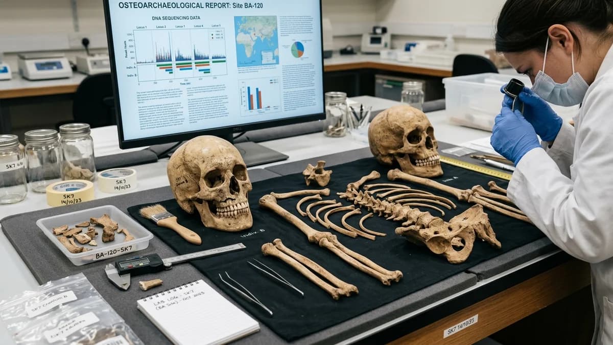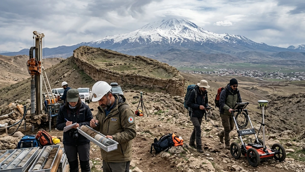
A series of multidisciplinary scientific campaigns conducted by Turkish universities and international geophysical teams at the enigmatic Durupınar Formation — a natural boat-shaped landform located in the Doğubayazıt district of Ağrı Province, roughly 30 kilometers south of majestic Mount Ararat —, has reignited global debate over the legendary Noah's Ark. The field investigation, coordinated by Ağrı İbrahim Çeçen University (AİÇÜ) under the leadership of Vice Rector Prof. Dr. Faruk Kaya, in partnership with the Geological Engineering Department of Istanbul Technical University (İTÜ) and archaeologists from Sivas Cumhuriyet University led by Prof. Dr. Cenker Atila, carried out diamond core drillings down to 18 meters and retrieved hundreds of stratigraphic soil and bedrock samples from inside the anomaly. Laboratory analyses utilizing spectrometry and X-ray diffraction revealed layers rich in clayey materials, mineralized marine substances, and organic carbon radiocarbon-dated to between 5500 BC and 3000 BC (the Chalcolithic to Early Bronze Age transition), a timeframe overlapping with the rise of early agricultural communities on the Armenian Highlands.
However, contrary to sensationalist headlines circulating in tabloids and social networks claiming the physical discovery of the biblical and Quranic wooden vessel, the lead scientists themselves and the international geological community emphasize that the evidence must be interpreted with extreme caution. Prof. Dr. Faruk Kaya formally warned that detecting organic compounds and waterborne sediments in 7,000-year-old layers attests to ancient human habitation and past alluvial activity within the Doğubayazıt basin, but does not constitute proof that the rocky ridge is the petrified hull of a ship. For structural geologists and independent volcanologists, the Durupınar site is a classic doubly plunging syncline sculpted by mudflows and differential erosion, in which blocks of ophiolitic rocks and marine limestones were thrust upward by the collision of the Eurasian and Arabian tectonic plates.
The enduring fascination surrounding Noah's Ark enters a new era as modern geophysics replaces myth with empirical material inquiry. Whereas amateur expeditions of the past generated notorious hoaxes on the icy slopes of Mount Ararat — such as the infamous 2010 scandal in which modern timber was planted inside glacial caves to fabricate an archaeological site —, the recent Durupınar drillings represent the first methodical effort to map the subsurface in three dimensions using Ground-Penetrating Radar (GPR) and electrical resistivity tomography. Analyzing in detail what science has verified, what remains working hypothesis, and how ancient catastrophic river floods across Mesopotamia and the Black Sea inspired the flood epics is the central purpose of this investigative dossier.
The 1959 Aerial Discovery and the Global Fascination with Durupınar's Naval Silhouette
The scientific and popular history of the Durupınar site began in the autumn of 1959 during a routine military geodetic mapping mission conducted by the Turkish Air Force on behalf of NATO. While examining stereoscopic black-and-white aerial photographs taken from thousands of meters above Turkey's eastern borderlands with Iran, Turkish Army Captain İlhan Durupınar spotted a bizarre topographic prominence rising from an undulating landslide terrain: an elliptical ridge with symmetrical borders pointing northward, measuring exactly 157 meters in length by approximately 50 meters in width across its midsection. The striking silhouette bore an unmistakable resemblance to the hydrodynamic hull of a massive vessel stranded on a mountainside at an elevation of 1,980 meters above sea level.
The publication of the photograph in international magazines, including a classic feature in America's Life magazine in September 1960, sparked immediate worldwide curiosity among researchers and biblical scholars. The physical length of the formation — roughly 157 meters — aligned almost perfectly with the dimensions described for the Ark in the Book of Genesis, which specifies 300 cubits in length (equating to approximately 150 to 157 meters, assuming an ancient Egyptian or Mesopotamian royal cubit of 52 centimeters). An initial expedition led by businessman George Vandeman and Turkish military officers traveled to the site in 1960 equipped with picks and light dynamite to blast a section of the perimeter hoping to uncover petrified wooden beams, but early excavations uncovered only compacted earth, basalt blocks, and grey clay, temporarily cooling academic interest.
The revival of the site occurred in the late 1970s when amateur American explorer Ron Wyatt visited the area following an earthquake that cracked the soil around the formation, making the boat-shaped ridge stand out even more prominently from the surrounding terrain. Wyatt promoted sensational claims without scientific methodology, asserting he had identified metal alloy rivets containing titanium and aluminum, stone drogue anchors with rope holes, and deck timbers laminated with bitumen. Decades later, rigorous geochemical examinations conducted by accredited laboratories demonstrated that the supposed "titanium rivets" were ordinary nodules of iron oxide and magnetite common to altered volcanic rocks, and that claims of petrified timber were products of pure visual pareidolia.
Recent University Campaigns: Deep Core Drillings, Georadar, and Laboratory Testing
Beginning in 2022, the investigation of Durupınar moved beyond amateur expeditionaries and came under the official oversight of Turkish public academic consortia. Under the leadership of Ağrı İbrahim Çeçen University (AİÇÜ) and the prestigious Istanbul Technical University (İTÜ), the Mount Ararat and Noah's Ark Research Team (Ağrı Dağı ve Nuh'un Gemisi Araştırma Grubu) was formally established. For the first time in the site's history, credentialed scientists secured formal government permits to collect dozens of geological and bio-stratigraphic samples inside and outside the perimeter of Durupınar, submitting the materials to blind laboratory tests to evaluate mineralogical composition and potential prehistoric human signatures.
The Methodology of the Ağrı and Istanbul Technical University (İTÜ) Team
The field protocol implemented by İTÜ researchers paired high-resolution drone topographic mapping with subsurface geophysical imaging. Geophysicists deployed Ground-Penetrating Radar (GPR) antennas operating across frequencies from 100 MHz to 400 MHz alongside Electrical Resistivity Tomography (ERT) to track dielectric density contrasts down to depths of 18 to 20 meters. The computer-generated tomograms revealed structural anomalies beneath the surface, including horizontal bedding planes and angular cavities that some project members interpreted as potential internal voids warranting physical verification through core drilling.
In subsequent field seasons coordinated by archaeologist Prof. Dr. Cenker Atila of Sivas Cumhuriyet University, vertical core drillings were executed using diamond-tipped rotary drills at multiple strategic points along the anomaly's central axis. The drill rigs extracted continuous cylindrical bedrock and sediment cores, yielding more than 1,000 individual samples partitioned between the superficial crust, intermediate silt layers, and deep bedrock basements. The sealed core trays were transported to İTÜ's advanced mineralogy laboratories in Istanbul, where they underwent X-ray diffraction (XRD), scanning electron microscopy (SEM), and accelerator mass spectrometry (AMS) for radiocarbon dating.
What Did the 5500 BC to 3000 BC Soil Samples Reveal?
Preliminary laboratory reports announced by Prof. Dr. Faruk Kaya confirmed the presence of fine clayey fractions, lacustrine and marine sedimentary indicators, and anomalous organic carbon concentrations within specific depth horizons of the formation. Radiometric dating of these organic fractions placed the depositional layer between 5500 BC and 3000 BC, corresponding directly with the Chalcolithic and Early Bronze Age archaeological chronology of Eastern Anatolia. Furthermore, surface surveys on neighboring hills recovered prehistoric ceramic shards characteristic of sedentary communities that inhabited the plains surrounding Doğubayazıt during the fourth millennium BC.
The chronological revelation sparked intense worldwide excitement because the 5,000 to 7,500-year-old timeframe aligns chronologically with traditional dates some scholars associate with major ancient Near Eastern riverine flood traditions. Nevertheless, the İTÜ researchers and Prof. Faruk Kaya were unequivocal in their statements: detecting aquatic micro-indicators and Bronze Age organic soil proves that the area once held a perennial wetland or lake inhabited by ancient humans, but does not contain structural evidence of shaped timbers, pitch caulking, or preserved animal remains. The data attests to prehistoric human occupation in an extinct basin, not the wreckage of a biblical menagerie.
The Geological Verdict: Syncline, Ophiolites, and the Illusion of a Petrified Ship
For structural geologists who study the complex plate tectonics of the Anatolian plateau, the boat-like morphology of Durupınar is not an insoluble mystery, but a natural formation extensively documented in global geological literature. Internationally renowned geologists, such as Dr. Lorence G. Collins, professor emeritus of geology at California State University, Northridge, and researcher David Fasold — who originally believed in the vessel's authenticity but reversed his position after rigorous laboratory work —, demonstrated that the formation is the result of compressive tectonic stresses combined with differential erosion and viscous mudslides.
The Durupınar structure consists of a doubly plunging syncline, an inverted, canoe-shaped fold in the Earth's crust where sedimentary and volcanic rock strata were bent downward by compressive forces generated by the collision between the Eurasian and Arabian tectonic plates. The visible "hull" corresponds to resistant layers of limestone and volcanic breccias that withstood wind and water erosion, while softer surrounding clayey soils flowed downhill as colluvial mudflows (lahars and landslides). As the viscous mud flowed around this rigid central rock core, it sculpted the edges into smooth hydrodynamic curves, imparting an elliptical shape that mimics a boat's hull.
The presence of marine mineral signatures and microfossils in samples analyzed by İTÜ is another element that geology explains without requiring a catastrophic global deluge covering high mountains. During the Mesozoic Era and early Cenozoic (between 200 million and 30 million years ago), the entire region of Anatolia, the Caucasus, and the Middle East formed the floor of the ancient Tethys Ocean, an equatorial seaway separating Laurasia from Gondwana. When the closing of the Tethys Ocean forced the seafloor upward during the Alpine-Himalayan orogeny, massive slices of oceanic crust — known as ophiolite complexes — were tectonically uplifted into Turkey's mountain ranges, loaded with marine limestones, foraminifera microfossils, and saline marine clays that now rest naturally at elevations exceeding 2,000 meters.
The Volcanic Reality of Mount Ararat and Historical False Alarms
The traditional search for Noah's Ark on the glaciated summit of Mount Ararat itself (Ağrı Dağı, standing at 5,137 meters) faces geological and volcanological barriers even more insurmountable than those at Durupınar. The mountain is not an ancient, tranquil sedimentary plateau that could host the gentle landing of a floating ship, but a colossal andesitic-basaltic composite stratovolcano whose violent eruptions built the peak over hundreds of thousands of years and remained active into historical times.
Why Mount Ararat's Volcanic History Precludes Ancient Wood Preservation
From a volcanological standpoint, the upper slopes of Mount Ararat represent one of Earth's most hostile and destructive environments for the survival of organic material. The mountain's last catastrophic eruption occurred on July 2, 1840, triggered by an estimated magnitude 7.4 earthquake accompanied by phreatic blasts, pyroclastic surges, and a massive lahar of molten ice and volcanic rubble that surged down the Ahora Gorge, entirely burying the Armenian village of Akuri and the ancient St. Jacob monastery. Any wooden structure resting on the upper volcanic slopes would have been incinerated by superheated gases or obliterated by the tumbling volcanic avalanches that reshaped the peak in the 19th century.
Beyond active volcanism, the glaciological dynamics of Mount Ararat's summit ice cap prevent large man-made structures from remaining intact across millennia. The glaciers blanketing the upper 800 vertical meters of the volcano are not static ice cubes, but plastic, constantly shearing ice masses flowing downhill, opening deep crevasses, and grinding against basalt bedrock. Any wooden vessel buried within the glacier would have been mechanically shredded by glacial motion within decades, alongside rapid decay during seasonal summer freeze-thaw cycles.
The 2010 False Alarm and the Rigor of Forensic Archaeology
Desperation to find tangible proof of the Ark on Mount Ararat has repeatedly fostered egregious archaeological hoaxes. The most prominent episode unfolded in April 2010, when a Hong Kong-based evangelical group named Noah's Ark Ministries International (NAMI) announced in a global press conference that it had discovered intact wooden rooms at an altitude of 4,000 meters on Mount Ararat, showcasing video of timber walls and claiming carbon-14 tests dated the wood to 4,800 years old. The international media frenzy was immense, but quickly collapsed under scholarly scrutiny.
Renowned biblical archaeologist Dr. Randall Price, who was conducting licensed field research in the area, joined other researchers to trace the origin of the find. Formal testimonies from local Kurdish mountain guides and photographic documentation revealed that the wooden beams shown in the NAMI videos had been salvaged from old structures near the Black Sea, hauled up the mountain on pack horses, and deliberately constructed inside a volcanic cave packed with snow to stage the scene of a petrified ark. The scandal served as a permanent reminder to the scientific community that extraordinary historical claims require rigorous, independent archaeological oversight.
The Historical Roots of the Flood: From Mesopotamia to the Black Sea and Mount Cudi
If archaeology and geology refute the existence of a petrified 150-meter ship atop an active volcano or inside a synclinal ridge, where did the universal Flood narrative originate? The answer from historians and Assyriologists lies in cultural memories of real climatic and hydrological catastrophes experienced by Middle Eastern riverine civilizations during the Holocene.
Centuries before the Hebrew Pentateuch was penned, Mesopotamian scribes recorded poetic narratives on cuneiform clay tablets detailing a catastrophic deluge and a surviving hero instructed by the gods to build a pitch-sealed boat. The Sumerian Eridu Genesis (featuring King Ziusudra), the Old Babylonian Epic of Atrahasis (18th century BC), and Tablet XI of the Epic of Gilgamesh (where Utnapishtim recounts the flood) all describe torrential storms that caused the Tigris and Euphrates rivers to overflow catastrophically. Stratigraphic excavations led by British archaeologist Sir Leonard Woolley at ancient Sumerian cities like Ur, Kish, and Shuruppak revealed sterile alluvial silt deposits up to 3 meters thick laid down by massive river floods circa 2900 BC, localized events so devastating they appeared to submerge the entire known world.
Another prominent scientific hypothesis is the Black Sea Deluge Theory, proposed in 1997 by Columbia University marine geologists William Ryan and Walter Pitman. According to oceanographic cores, the Black Sea was an isolated freshwater lake during the Last Glacial Maximum; around 5600 BC, rising global sea levels caused the Mediterranean to violently breach the Bosporus bedrock sill, pouring hundreds of times the volume of Niagara Falls daily and permanently submerging more than 100,000 square kilometers of coastal farmland. This catastrophic inundation forced neolithic farming populations to flee through the Caucasus and Anatolia, embedding an indelible collective trauma of a submerged homeland into ancient Near Eastern mythologies.
Furthermore, within Turkey itself, Islamic tradition and early Christian communities locate the Ark in an entirely different geographical region than Mount Ararat. The Quran (Surah Hud 11:44) explicitly states that the Ark came to rest upon Mount Judi (Jabal Judi or Cudi Dağı, standing at 2,089 meters), situated in Şırnak Province in southeastern Turkey near the borders of Iraq and Syria. Throughout late antiquity and the Middle Ages, Mount Cudi was a major pilgrimage site for Jews, Christians, and Muslims with monastery shrines erected to commemorate the end of the flood, centuries before Western explorers mistakenly focused their searches on Mount Ararat.
Comparative and Scientific Table: Forensic Evaluation of Sites Associated with Noah's Ark
To synthesize the multidisciplinary findings gathered by universities, geophysicists, archaeologists, and geologists regarding the most prominent sites linked to the Flood narrative, we present the following forensic comparison:
| Investigated Site / Location | Elevation / Coordinates | Applied Physical Evidence / Scientific Methodology | Current Archaeological and Geological Verdict |
|---|---|---|---|
| Durupınar Formation (Doğubayazıt, Ağrı, Turkey) | 1,980 m elevation; 39°26'N, 44°14'E | 18 m diamond core drillings by İTÜ/AİÇÜ; organic soil dated to 5500–3000 BC; GPR scans | Natural geological doubly plunging syncline; confirms prehistoric Chalcolithic human occupation |
| Mount Ararat Summit (Ağrı Dağı, Turkey) | 5,137 m elevation (glacial volcanic summit) | Satellite remote sensing of ice cap; high-altitude glaciological monitoring | Physical impossibility; active stratovolcano whose 1840 eruption and moving glaciers destroy organic timber |
| Ararat Anomaly (Northwest Plateau of Mount Ararat) | 4,720 m elevation; glacial slope | U.S. Air Force aerial reconnaissance (1949); commercial IKONOS and QuickBird satellite imagery | Optical illusion created by sunlight and shadow on a natural right-angled basalt ridge beneath snow |
| Ararat Glacier — NAMI Case (2010 Hong Kong Expedition) | ~4,000 m elevation inside a volcanic cave | Video footage of supposed timber walls and partitioned rooms presented to the media | Proven fraudulent; modern wooden beams salvaged from the Black Sea were hauled up by local guides |
| Mount Judi / Cudi Dağı (Şırnak, Southeastern Turkey) | 2,089 m elevation; Tigris River basin | Ruins of ancient Christian monastery and Islamic shrine (Masjid al-Safina); Quranic tradition (11:44) | Traditional historical pilgrimage site of the Byzantine and early Islamic eras; no wooden vessel preserved |
| Alluvial Layers of Ur and Kish (Southern Mesopotamia / Iraq) | Alluvial floodplains of the Tigris and Euphrates rivers | Sir Leonard Woolley excavations (1929); 2 to 3-meter sterile water-deposited silt layers | Physical sedimentary proof of regional riverine mega-floods circa 2900 BC; basis for the Gilgamesh epic |
| Black Sea Continental Shelf (Bosporus and Northern Turkey) | -100 m to -150 m below modern sea level | Marine seismic soundings and radiocarbon dating of freshwater shell die-offs (Ryan & Pitman) | Catastrophic Bosporus breach circa 5600 BC; historical geoclimatic event that inspired ancient flood legends |
| Mountains of Urartu (Gordyene) (Armenia / Eastern Anatolia) | Regional mountain ranges from 1,500 m to 3,000 m | Original Hebrew biblical text specifies plural (mountains of Ararat/Urartu), not a solitary peak | "Ararat" in biblical geography designated the broad Kingdom of Urartu, not the isolated stratovolcano |
The scientific consensus makes clear that while the Flood narrative is rooted in real climatic and hydrological disasters that shook early agricultural societies, no colossal wooden ark exists petrified atop Eastern Turkey's mountains. The Durupınar drillings offer invaluable insights into the paleoclimate and Chalcolithic settlements of the Ağrı basin, but the boat-shaped ridge remains an impressive masterpiece of natural tectonic sculpture.
Frequently Asked Questions (FAQ)
Did science confirm the discovery of Noah's Ark at the Durupınar formation?
No, the scientific community and the universities conducting research at Durupınar have never claimed to have discovered Noah's Ark. Collaborative studies by Ağrı İbrahim Çeçen University (AİÇÜ) and Istanbul Technical University (İTÜ) identified subsurface geophysical anomalies with ground-penetrating radar and collected soil samples dating between 5500 BC and 3000 BC, demonstrating Chalcolithic human activity and aquatic sediments in an ancient basin. AİÇÜ Vice Rector Prof. Dr. Faruk Kaya explicitly clarified that these findings attest to ancient human habitation rather than a ship, while independent structural geologists have firmly established that the boat-shaped ridge is a natural doubly plunging syncline.
Why do 5500 BC soil samples and marine microfossils fail to prove that the Ark landed there?
The presence of waterborne sediments and marine microfossils across the mountains of Eastern Anatolia is a direct consequence of deep plate tectonics, rather than a recent global deluge covering mountain peaks 5,000 years ago. For tens of millions of years, the territory of modern Turkey formed the floor of the ancient Tethys Ocean depositing massive limestone beds, which were later elevated thousands of meters into mountain ranges during the Cenozoic collision of the Eurasian and Arabian plates. Furthermore, the 5500 BC organic samples reflect wetland vegetation and agriculture typical of Chalcolithic villages situated near prehistoric lakes.
Why do geologists and volcanologists consider it impossible for a wooden ark to survive on Mount Ararat?
Mount Ararat is an active composite stratovolcano that experienced violent eruptions throughout human history, including a catastrophic blast on July 2, 1840, which buried an entire village beneath pyroclastic flows and debris avalanches. Any wooden structure exposed on the volcanic flanks would have been incinerated by superheated volcanic gases or pulverized by tumbling boulders, while the active summit glacier exerts crushing shear pressures that grind wooden structures within decades. Therefore, the long-term preservation of an intact wooden ship on Mount Ararat's summit directly violates established laws of physical geology and glaciology.
Official References and Sources
For direct access to academic reports, structural geology analyses, and archaeological field surveys supporting this investigation, consult the following accredited sources:
- Istanbul Technical University (İTÜ) — Geological Engineering Department Field Reports and Analytical Results for Doğubayazıt
- Ağrı İbrahim Çeçen University (AİÇÜ) — Institutional Research Portal and Official Statements by Prof. Dr. Faruk Kaya
- Sivas Cumhuriyet University — Archaeological Field Surveys and Expedition Coordination by Prof. Dr. Cenker Atila
- Geological Society of America (GSA) — Research on Ophiolite Tectonics and Synclinal Landforms across the Anatolian Plateau
- National Center for Science Education (NCSE) — Investigative Geological Analysis by Dr. Lorence G. Collins on Durupınar